3D Mapping
High-resolution 3D mapping for detailed subsurface analysis.
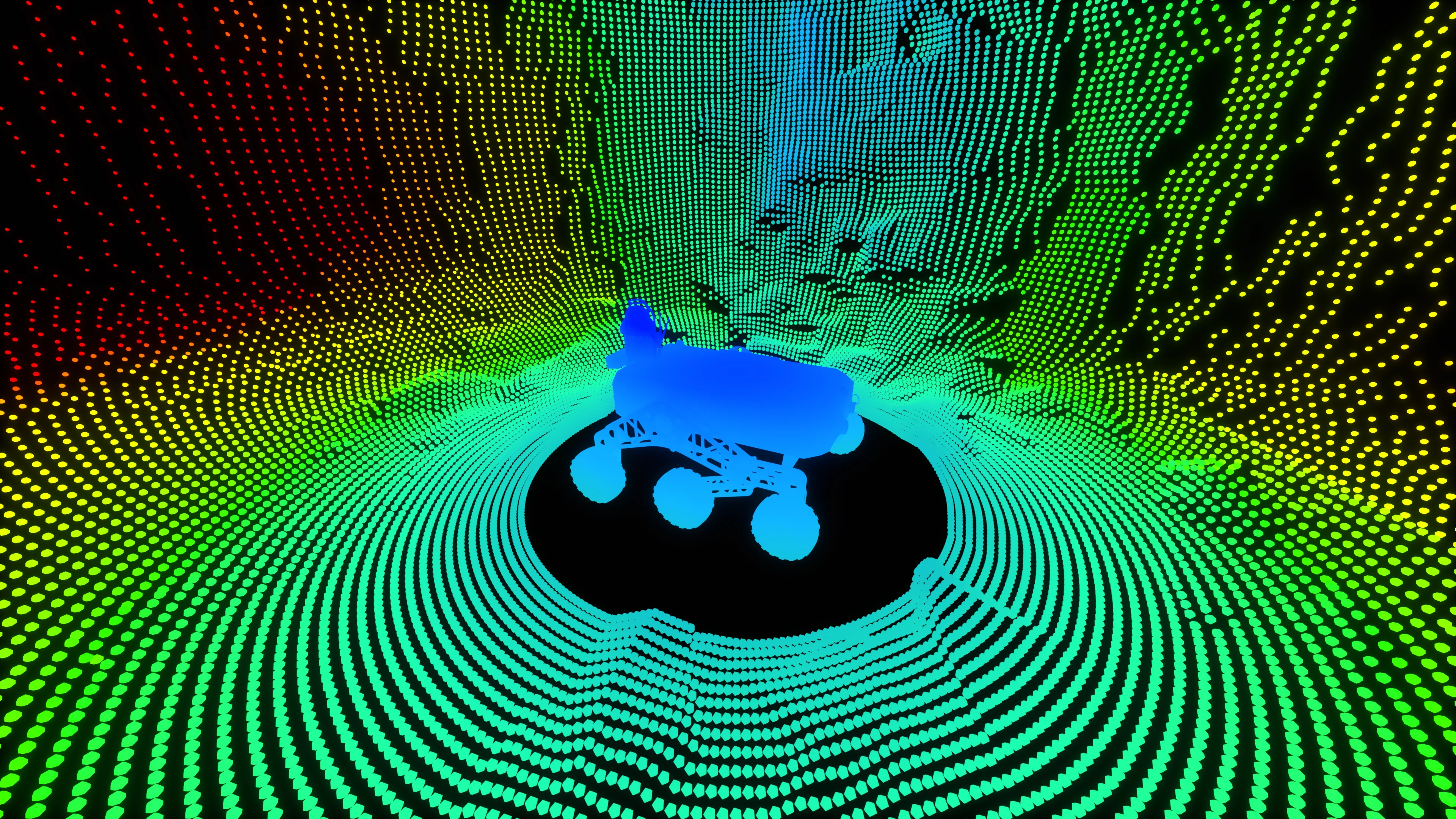
AutoJoe® for 3D Mapping
Equipped with 3D mapping sensors, AutoJoe® autonomously maps underground environments.
The Critical Problem
Manual 3D mapping in underground mines is not only dangerous and labor-intensive; it's often unreliable and incomplete. Delays in mapping can lead to severe health hazards, operational shutdowns, or even fatal incidents.
Oinride's Solution
AutoJoe®, equipped with 3D mapping sensors, autonomously maps underground environments. It continuously scans air quality across tunnels, haul roads, and confined zones, delivering alerts instantly to your command center.
Technical Specifications
Advanced 3D mapping capabilities with precision sensors for accurate subsurface visualization.
Key Benefits
Proactive 3D mapping that saves lives and prevents costly downtime.
Continuous Mapping
Continuous mapping of underground environments.
Reduced Human Dependency
Reduces dependency on human inspection in hazardous zones.
Implementation Process
A streamlined process to integrate automated 3D mapping into your mine's safety protocols.
Patrol Deployment
Robot autonomously patrols designated areas following pre-programmed safety routes
3D Mapping
Continuous 3D mapping of underground environments